Environment

July 20, 2011

EC Official Adds Galileo, EGNOS Worries to FCC’s LightSquared-GPS Deliberations

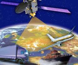
European Geostationary Navigation Overlay Service (EGNOS). ESA illustration

Citing European Space Agency (ESA) studies that showed “harmful interference” to Galileo receivers operating up to 1,000 kilometers from LightSquared base stations, a European Commission (EC) official has told the Federal Communications Commission (FCC) about his “deep concerns” about the wireless broadband company’s terrestrial transmissions in the 1525–1559 MHz band next to L1 GNSS frequencies.

Read More >

By Inside GNSS
July 5, 2011

Lockheed Martin Team Completes GPS IIIB System Design Review

GPS III satellite. Lockheed Martin illustration

Lockheed Martin has announced the successful, on-schedule completion of a system design review (SDR) for the second-phase of next-generation GPS satellite development, the IIIB increment.

The company’s Space Systems division in Newtown, Pennsylvania, is under contract to produce the first two of a planned eight GPS IIIA satellites, with first launch projected for 2014. The contract includes a Capability Insertion Program (CIP) designed to mature technologies and perform rigorous systems engineering for future GPS III increments.

Read More >

By Inside GNSS
[uam_ad id="183541"]
May 19, 2011

Homeland Security Steps Up to Protect GPS (But Not from LightSquared)

After a long series of fits and starts, the Department of Homeland Security is tackling the issue of interference to the GPS signal. The agency has launched a study to assess the risks to GPS service from a variety of sources — a study that, at least on paper, will lead to a plan to mitigate interference.

Unfortunately, the effort will not directly address the one potential problem consuming the thoughts of the GPS community — widespread receiver overload from the high-powered mobile broadband service proposed by the Virginia firm LightSquared.

Read More >

By Dee Ann Divis
March 12, 2011

Registration opens for 2011 GPS Partnership Council Meeting at Los Angeles AFB

A Coast Guard search and rescue helicopter demonstrates the use of GPS technology at a previous GPS Partnership Council meeting. (Photo: Joe Juarez)

Registration is now open for the 2011 GPS Partnership Council meeting on Tuesday, May 3 and Wednesday, May 4 at the Space and Missile Systems Center (SMC) at Los Angeles Air Force Base in El Segundo, California. 

These military and industry networking meetings, now in their 11th year, are sponsored by the Los Angeles chapter of AFCEA (Armed Forces Communications Electronics Association) and the USAF GPS Directorate, formerly the GPS Wing. 

Read More >

By Inside GNSS
February 27, 2011

LightSquared, GPS Industry Council Propose Process for Assessing GPS Interference Risks

Photo: Wikimedia Commons

Attorneys for LightSquared Subsidiary LLC submitted a proposed work plan on Friday (February 25, 2011) for analyzing potential interference to GPS devices. The plan, required by the FCC as a condition of its granting a waiver to its Ancillary Terrestrial Component (ATC) rule for mobile satellite services (MSS), proposes to establish a working group (WG) to study the GPS overload/desensitization.

Read More >

By Inside GNSS
[uam_ad id="183541"]
January 24, 2011

Parimal Majithiya

Parimal Majithiya received his B.E. (electronics and communication) from Gujarat University and an M.Tech degree in satellite communications from Andhra University.

He joined the Indian Space Research Organization (ISRO), Space Applications center in 1987 and worked in the field of satellite communication and system engineering as a project manager.

Read More >

By Inside GNSS
September 16, 2010

ION 2011 International Technical Meeting

Catamaran Hotel, San Diego

The Institute of Navigation International Technical Meeting (ITM) will take place January 24-26 at the Catamaran Hotel on Mission Bay in San Diego California.

Paul Kline of Honeywell Aerospace is the general chair. Jade Morton of Miami University, Ohio, is the program chair.

"Robotics Navigation" is the plenary session topic. Invited speakers will discuss current trends and future technologies that support navigation for surveillance, search and rescue, undergound and underwater robotics and unmanned air vehicles.

Read More >

By Inside GNSS
August 17, 2010

A Search for Spectrum

In recent years, researchers have explored possible new allocations for Radio Determination Satellite Service (RDSS) and Radio Navigation Satellite Service (RNSS) spectrum from a regulatory point of view. These studies have mainly discussed S-band and C-band in addition to L-band.

The International Telecommunications Union (ITU) Radio Regulations define RNSS as a subset of RDSS. Although the allocations are differentiated — RDSS usually has a paired uplink — both can actually be used for satellite navigation.

Read More >

By Inside GNSS
July 30, 2010

China Launches 4th BeiDou Navigational Satellite

A Compass/Beidou-2 geostationary satellite is lifted into space from China’s Xichang space center. (China Academy of Launch Vehicle Technology photo)

[Reprinted with permission from NAVIBIZ, Issue Date: 2010-6-18]

At 23:53 on June 2, China successfully launched the 4th BeiDou navigational satellite into the pre-designated orbit with the "Long March 3C" carrier rocket at the Xichang Satellite Launch Center, symbolizing that China has made another important step forward in building the BeiDou (COMPASS) Navigation Satellite System. The construction of COMPASS follows the principles of openness, independency, compatibility, and gradualness.

Read More >

By Inside GNSS
June 28, 2010

Obama’s National Space Policy Authorizes Use of Foreign GNSS Services to Strengthen GPS

A new U.S. National Space Policy announced today (June 28, 2010) by the White House says that foreign GNSS services may be used “to augment and strengthen the resiliency of GPS.”

In a document that underlines the Obama administration’s intention to rely more on international cooperation in space-related activities and “energize competitive domestic industries to participate in global markets,” the new policy reaffirms recent efforts “to engage with foreign GNSS providers to encourage compatibility and interoperability, promote transparency in civil service provision, and enable market access for U.S. industry.”

Read More >

By Inside GNSS
June 7, 2010

DLR, Stanford Track First GPS IIF Signals; Tests Begin on L5

GPS IIF SV1 Spectral Flux Density on L1. DLR figure

[Updated June 10] The U.S. Air Force announced today (June 10) that it has begun
testing the new operational L5 signal transmitted by the first GPS IIF satellite (space vehicle 1 or SV1 — designated SVN-62 in the overall GPS system), which was launched May 27.

On June 7, 2010, a team of experts from the German Aerospace Center (DLR) and Stanford University in California reported results of their tracking of the first navigation signals from the satellite, the pseudorandom noise code 25 (PRN25) on L1 and L2 — C/A and P(Y).

Read More >

By Inside GNSS
IGM_e-news_subscribe